|
|
 |
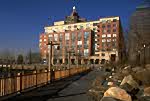
River Rose
333 Rector Place
232 Units - rental - (212) 945-4030
Rockrose Development Corp.
Charles Moore, architects
w/ Rothzeid Kaiserman Thomson & Bee |
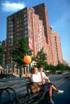 |
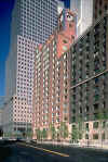
Hudson Tower
350 Albany Street
134 Units - condominium - (212) 945-2329
Zeckendorf Co. & Worldwide Realty Co.
Center for Housing Partnerships
Davis,Brody & Associates, architects |
 |
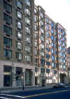
Hudson View East
250 South End Avenue
109 Units - condominium - (212) 945-4346
The Zeckendorf Co.& Worldwide Realty
Conklin Rossant and Mitchell/Giurgola, architects |
 |
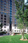
Hudson View West
300 Albany Street
108 Units - condominium - (212) 945-3524
The Zeckendorf Co. & Worldwide Realty
Conklin Rossant and Mitchell/Giurgola, architects |
 |
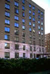
Parc Place
225 Rector Place
307 Units - rental - (212) 945-0500
LRF Developers, Inc.
The Related Companies
Gruzen Samton Steinglass, architects |
 |
Soundings
280 Rector Place
122 Units - condominium - (212) 945-4334
Planning Innovations Inc.
Housing Innovations, Inc.
The Related Companies
Bond Ryder James, architects |
 |
Battery Pointe
300 Rector Place
154 Units - condominium - (212) 945-0585
Planning Innovations Inc.
Housing Innovations, Inc.
The Related Companies
Bond Ryder James, architects |
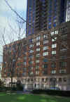 |
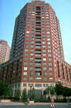
Liberty Court
200 Rector Place
547 Units - condominium - (212) 945-1002
Joint venture of Goodstein
Construction Corp./Milstein Properties/Cara Associates
Ulrich Franzen, The Vilkas Group, James Stewart Polshek & Partners,
architects |
 |
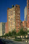
Liberty Terrace
380 Rector Place
247 Units - condominium - (212) 945-2483
Joint venture of Goodstein
Construction Corp./Milstein Properties/Cara Associates
Ulrich Franzen, The Vilkas Group, James Stewart Polshek & Partners,
architects |
 |
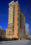
Liberty House
377 Rector Place
240 Units - (212) 945-0035
Joint venture of Goodstein Construction Corp./Milstein
Properties/Cara Associates
Ulrich Franzen/The Vilkas Group and James Stewart Polshek &
Partners, architects |
| The
infrastructure (roads, sewers, and utilities) was built by the
Authority. Construction on the first building, River Rose, began in
spring 1984. Liberty Court, the last of the buildings in Rector
Place, opened in the late fall 1987.
Battery Place Neighborhood
The Battery Place residential area is located south of the Rector
Place development. Construction of the infrastructure began in
spring 1985 and was completed in summer 1986.
The Authority designated three development teams to design and
construct the initial three buildings following the specifications
outlined in the the Authority's Design Guidelines and the 1979
Master Plan. Six sites remain to be developed.
The developers for each building and their architects were: |
 |
Liberty View
99 Battery Place
294 Units - condominium - (212) 693-8300
Milstein Properties
Ehrenkrantz, Eckstut & Whitelaw and Costas Kondylis, architects |
 |
The Regatta
21 South End Avenue
182 Units - condominium - (212) 786-0276
Property Resources Corporation
Gruzen Samton Steinglass, architects |
 |
Cove Club
2 South End Avenue
163 Units - condominium - (212) 786-4461
Goodstein Properties and Kreisler Borg Florman
Polshek & Partners, architects |
 |
The Museum of Jewish Heritage
18 First Place - (212) 968-1800
The New York Holocaust Memorial Commission built the Museum of
Jewish Heritage - A Living Memorial to the Holocaust on the western
side of Site 14. Ground was broken in October 1994. The building was
designed by Roche Dinkeloo, architects. |
| Construction
began in the summer of 1998 on two new residential buildings in the
Battery Place Neighborhood, as follows: |
|
River Watch
70 Battery Place
Approximately 200 units - (212) 863-3006
The Brodsky Organization and Opus One Limited
Hardy Holtzman Pfeifer, architects |
|
South Cove Plaza
Approximately 200 units
The DeMatteis Organization
Hardy Holtzman Pfeifer, architects |
| Construction
is expected to begin in the summer of 1999 on the following project: |
|
Ritz Carlton
Hotel & Condominiums/Skyscraper Museum
300 hotel rooms
150 condominiums
Millenium Partners
Polshek & Partners, and Gary Edward Handel & Associates, architects |
|
|
|
From Wikipedia, the free
encyclopedia.
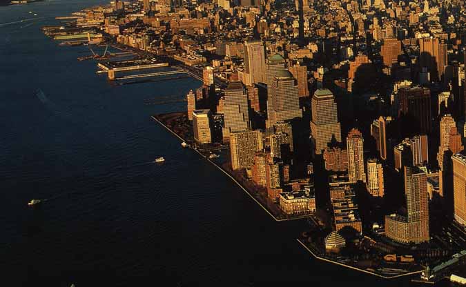
Battery Park City
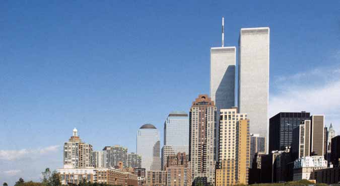
is a 90-acre (36.5 hectare)
planned community at the southwestern tip of
Manhattan
in
New York City. The land upon which it stands was reclaimed from the
Hudson river using 1.2 million cubic yards (917,000 cubic meters) of
dirt and rocks excavated during the construction of the
World Trade Center and certain other construction projects. The
neighborhood, which is the site of the
World Financial Center along with numerous housing, commercial and
retail buildings, is named for adjacent
Battery Park.
Battery Park City is owned and managed by
the
Battery Park City Authority, a
public corporation that is not controlled by New York City. Excess
revenues from the area are contributed to other housing efforts,
typically low-income projects in the
Bronx
and
Harlem.
Battery Park City is bounded on the east by
West Street, which insulates the area from the Financial District of
downtown Manhattan. To the east, north and south, the area is surrounded
by the tidal estuary of the Hudson River.
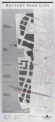
The development consists of roughly five
major sections. Travelling north to south, the first neighborhood, aptly
referred to by the BPCA as the "North Residential Neighborhood",
consists largely of park, a few residential buildings, and a large
hotel.
Immediately to the south lies the World
Financial Center area, a complex of several commercial buildings
occupied by tenants including
American Express and
Dow Jones & Company. The area of the Financial Center also includes
a steel-and-glass greenhouse known as the
Winter Garden and a large
yacht
harbor.
South of the World Financial Center lies
the majority of Battery Park City's residential areas, in three
sections: "Gateway Plaza", the "Rector Place Residential Neighborhood"
and the "Battery Place Residential Neighborhood". These neighborhoods
contain most of the area's residential buildings, along with park space
and various types of supporting businesses (supermarkets,
restaurants,
movie theatres.) Construction of residential buildings began north
of the World Financial Center in the late 1990s.
By the late 1950s, the once prosperous port
area of downtown Manhattan was occupied by a number of dilapidated
shipping piers, casualties of the rise of air transport. The initial
proposal to reclaim this area through landfill was offered in the early
1960s by private firms and supported by the Mayor. This plan became
complicated when Governor
Nelson Rockefeller announced his desire to redevelop a part of the
area as a separate project. The various groups reached a compromise, and
in
1966
the governor unveiled the proposal for what would become Battery Park
City. The creation of architect
Wallace K. Harrison, the proposal called for a 'comprehensive
community' consisting of housing, social infrastructure and light
industry. In
1968, the
New York State Legislature created the
Battery Park City Authority (BPCA) to oversee development.
For the next several years, the BPCA made
slow progress. In
1969, it unveiled a master plan for the area, and in
1972
issued $200 million in bonds to fund construction efforts. By
1976
the landfill was completed; in many cases, the pre-existing piers were
simply buried.
Construction efforts ground to a halt for
nearly two years beginning in
1977, as a result of city-wide financial hardships. In
1979, the title to the landfill was transferred from the city to the
BPCA, which financially restructured itself and created a new, more
limited master plan.
Construction began on the first residential
building in
1980, followed in
1981
with the start of construction on the World Financial Center, which saw
its first tenants in
1985. Throughout the 1980s, the BPCA oversaw a great deal of
construction, including the entire
Rector Place neighborhood and the river Esplanade. In the early
1990s, Battery Park City became the new home of the
Stuyvesant High School. By the turn of the century, Battery Park
City was mostly completed, with the exception of some ongoing
construction on West Street.
The
2001 World Trade Center Attack had a major impact on Battery Park
City. More than two thirds of the area's residents fled after the
adjacent
Trade Center towers collapsed. Gateway Plaza, the largest of the
residential buildings, was punctured by airplane parts, and the Winter
Garden was severely damaged. Environmental concerns regarding dust from
the Trade Center have also been a continuing source of worry. Since the
attacks, much of the damage has been repaired; reduced rents and
government subsidies have gone a long way to restoring residential
occupancy. Despite this, the area still has a long way to go before it
will be fully restored to pre-attack levels.
|
ASLA 2003 The Landmark Award
Battery Park City:
Master Plan and Esplanade
Original Landscape Architect:
Olin Partnership, Ltd.,
Philadelphia, PA, and R.M. Hanna Landscape Architects,
Philadelphia, PA (formerly Hanna/Olin)
Owner/Client: Hugh L. Carey Battery Park City
Authority
From its inception, the defining
vision for Battery Park City was to create a physical space
welcoming the diverse people of New York City to work, shop,
eat, play, relax, and, most important, live. This desire to
build a livable space has manifested itself in a world where
towers live alongside low-rise buildings set in a landscape of
rolling lawns, stretches of waterfront, and patches of sky.
Battery Park City is built on what was once 92 acres of landfill
and is now some of the most scenic and engaging open space in
New York City, establishing an urban fabric of mixed uses that
brought new life to lower Manhattan, sustaining it through
difficult and turbulent times. At the heart of its success is
the significant open space component that has resulted in a 1.2
mile esplanade, over 30 acres of parks, and streets that support
active public participation in the life of the city.
In the 1960’s Governor Nelson A.
Rockefeller believed that government could revitalize New York
City’s downtown economy through an innovative urban plan, and he
advocated the building of Battery Park City. During New York’s
fiscal crisis in the 1970’s, plans were put on hold. In 1979,
Hanna/Olin, in collaboration with two prominent New York
architects, created a master plan that has guided the long-term
development of Battery Park City with considerable success. The
master plan allocated a mix of uses that included 42 percent
residential, 9 percent commercial, 30 percent public open space,
and 19 percent streets and avenues. Battery Park City is proof
that great civic space plays a vital role in regenerating hope
and optimism. The Battery Park City Parks Conservancy, a
non-profit organization that maintains the green spaces,
demonstrated its commitment following the events of September
11, 2001, when its 70-member staff and workforce arrived in
force to begin the restoration of the gardens, most of which
were covered with up to a foot of dust and ash. Battery Park
City is a success because the Battery Park City Authority is a
visionary owner dedicated to sustaining the energy of the master
plan and being a patron of a well-designed public space.
|
| Click photo for larger
image. |
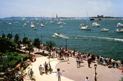 |
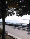
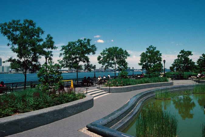
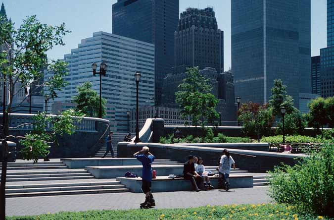
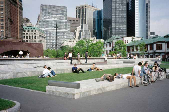
Esplanade at Rector Place. (Photo
by: Olin Partnership, Ltd.) |
| |
|
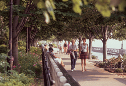 |
The esplanade in 2001 with mature
trees and plantings. (Photo by: StanRies.com) |
| |
|
 |
Winter on the esplanade. (Photo by:
StanRies.com) |
|
|
|
Battery Park City
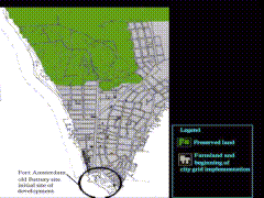
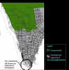
1. Plan of regional context |
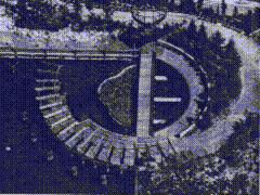
2. Landscape Character |
Project:
Battery Park City
Designer(s): Cooper Eckstut Association
Associated Professional(s): Mary Miss and Susan Child with
Hanna/Olin
Date(s):
Size: sqm
Location: Manhattan, New York, United States
Context:
- Battery Park City was originally lanfill
from the World Trade Centre, located directly adjacent to the site, and
fill was also dredged from the bottom of the Lower Bay. In 1968 the New
York State Legislature established the Battery Park City Authority and
plans for a new harbour were set forth in 1969. Cooper, Eckstut
Associates revised the orignal plan in 1979 which included 92 acres of a
residential and commercial community. The newly proposed 1979 Master
Plan was one ""that sought to capitalize on the riverfront as an
amenity, to tie the new development into the city's gridded street
system, and to accommodate a riverfront esplanade, squares, parks and
plazas. In the spirit of the times, contextualism and historic precedent
suggested models both for the plan itself and for the design criteria
that would mandate the character of individual development parcels. In
extending the pattern of lower Manhattan's blocks along a spine of two
major north/south avenues, care was taken to concentrate high-rise
commercial development in the area of the World Trade Center, now
connected by pedestrian bridges to the four towers of BPC's World
Financial Center."" The new Manhattan Harbour city consists of 14,000
units condominimum housing. The World Financial Centre is located
directly across from the World Trade Centre with residential communities
to the North and South linked by a 1.2 mile 70 foot wide esplanade. Two
types of walkways exist, an inner one that is formed by rows of trees
and beds of shrubberyk, grasses, or flowers, while the lower one is
broader and guides the visitor along the river's edge.The periphery is
lined with benches and a low iron-rail fence as well as lamposts. Public
parks, plazas and riverfront esplanade make up 30-40 per cent of the
site.
Battery Park City extends along East
River from Burling Slip to Peck Slip. A pedestrian area was
established to replace streets providing relief from the adjacent
Financial District. The city is a tourist attraction that
complements the popular observatory deck, restaurants and shops of
the World Trade Centre. Each of the large blocks were divided into
smaller blocks to maintain the concept of the Manhattan city grid
system. This allowed for developers to work with a smaller site and
thus increased their interest economically and socially. Guidelines
were derived from traditional New York city standards with respect
to the area's master plan and in terms of general requirements for
individual buildings.
Description:
- The revised plan of 1979 returns to the
historic grid pattern, which has been the form of street development for
Manhattan since 1811. As well as, the use of all that is desirable about
New York as a place for living. This includes the ""city""s system of
streets and blocks, its prevalent building forms, its density, its mixed
land use and its efficient transportation systems. This is to integrate
building forms of Battery Park City organically with existing
structures. Through the extension of streets there is less of a sense of
isolation. The rotated orientation of the street grid is to enhance the
visual quality of the main avenues so as to focus on the harbour. The
main avenues primarily consist of Shopping, school and social pedestrian
activities, where two different design features have been implemented.
On one side of the avenues an arcade that provides for all weather
situations with a 40 foot wide linear park running directly parallel.
Locating the Commercial Centre opposite
the World Trade Centre provides for easy access to the Lower
Manhattan subway systems. Access to the subway stations and PATH in
the World Trade Centre is the upmost importance since it is
estimated that 9231 of all work trips will are made by public
transportation.
The street system is organized as a
series of loops, each of which serves a specific part of the site.
The loops utilize the grid of the streets, but through the use of
one way streets they avoid creating conditions that would encourage
vehicular traffic to pass through the residential neighbour- hoods.
""Finally, that the streets of Battery
Park City are extensions of older ones is visible only in plan. From
an experiential point of view, West Street constitutes a barrier
between the two zones that's as effective as a concrete wall. For
the visitor, the process of entering Battery Park City reinforces
how unrelated and seemingly detached it is from the rest of
Manhattan. One arrives either as a motorist from West Street and
therefore many lanes of traffic away form the ""context,"" or as a
pedestrian who must choose between risking his or her life by
crossing West Street directly or not taking a street at all but
scutling in on an airport-like elevated walkway.""
Characteristics:
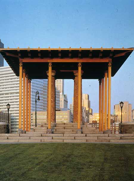
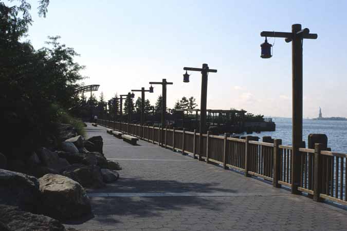
- South Cove is located at the the
southern most point of Battery Park City and is the termination point of
the esplanade.""South Cove bears the stamp of Miss""s earlier
explorations of the way that the experience of a natural landscape may
be taransformed and intensified by framing, screening or carefully
plotted movement through space."" Its design is intended to give visual
and physical acess to the waterfront that was previously blocked by
industrial development. This 3 acre public park was developed through
the idea of an interplay of forms and to create profoundly evocative
environs.
Main goals of the space:
Sense of place--The Hudson River--the
water, direct view of the Statue of Liberty and the danger of the
transition between earth and water
Concept: To never feel truly separate
from the water, a vague definition of spaces with barriers lingering
on a fine line. A strong concern with the visitors perception and
participation within the space and for them to be aware of the use
of the river.
1982, city of New York passed a law
""Percent for Art"" allowing for one per cent of the total budget of
every construction operation to include works of art. Public Art
works in Battery Park City were a collaboration of artists,
architects and landscape architects. Each differing in range and
linked together by an esplanade which was designed by Cooper Eckstut
Association (who worked on South Cove with Mary Miss and Susan
Child) with Hanna/Olin. ""The magic quality of this work lies in the
absolute articiality and uselessness in practical terms of each
singlw detail and of the whole, the sole aim being to create a
pleasant timeless atmosphere. Curved wooden jetties, too obviously
the work of craftsmen, false mooring posts, blue boat lamps,
simulated natural costal vegetation bounded by an irregular
composition of rocks (indiviually selected by Mary Miss in Maine),
All contribute to the light and gentle effect, without becoming
cliches. For the circular metal metal platform extending over the
water Mary Miss was inspired by the Statue of Liberty. Walking above
the water, one sees what Battery Park City really is filled water, a
construction on piles.""
Stanton Eckstut stated ""at a certain
point it was no longer clear who was the architect and who was the
artist."" He helped maintain a harmony of scale and style with the
surrounding area and while Susan Child was a guide for the character
of the park and her knowledge of the ecology of coves. Initially it
was a tug-of-war between the designers but they eventually learned
how to co-exist. South Cove is now considered the most successful of
the Fine Arts Program for the builders and people alike.
It serves many communities throughout
the day: joggers and bikers, the children and adults from the
immediate neighborhood of Tribeca, Wall Street employees and Battery
Park City residents. It is popular amongst New Yorkers of all social
classes and couples will go there to be alone in the evening. The
people of Manhattan now have access to the shoreline through an
elegant and spiritual place. Transition from one part to the next is
unobtrusive and it is un-noticible that this place was once a
landfill site.
The installation is of a japanese
character and flavour--from the colours to the choice and placement
of materials. Rocks seem randomly placed but were in fact carefully
situated by a crane operator directed by Mary Miss. These
irregularly shaped stones separate the garden from larger, formal
walkways by curving along the river and out on to the dock.
Related Materials:
- List of Books
Breen, Ann, & Rigby, ""Waterfronts
Cities Reclaim Their Edge"", New York: McGraw-Hill, 1994
Koolhass, Rem. Delirous New York, A
Retroactive Manifesto for Manhattan. New York Oxford University
Press 1978
Mackay, A. Donald.8888888888. Harper &
Row, Publishers New York
Manhattan Architecture pg.206 & 96
Manhattan Waterbound
(17th century Dutch Beginnings)
Articles on Battery Park City
Architectural Record. Battery Park
City: A new Residential skyline for downtown New York. December
1983, pp.28-29
Domus. Public Art A Battery Park City,
N.Y., 1982/90. Gennaio 1991. pp.78-84 Interiors, Interiors Platform
148:16+ F""89
Progressive Architecture,88888888. July
1983 Progressive Architecture, Building the New City, 69:86-93 Mr
""88 Progressive Architecture, West Side Waterfront, 69:21+ My ""88
Progressive Architecture, On the Waterfront: Art/Architecture
69:24-5 S ""88 Progressive Architecture, Waterfront Neighborhood,
71:120-1 Ja ""90
Progressive Architecture, Battery
Park's grand design. December 1983. pp.25
Articles on Mary Miss and South Cove
888888Studio Visit. Space Sculptor.
January 1993. pp.40-43
88888888The Jewel of Battery Park, A
Japanese Garden on Stilts. pp.169-172
8888888Climbing Parnassus. Mary Miss
(1944- ). pp.477-479
Landscape Architecture, Battery Park
City;Celebrating the River and the City, 79;51-7 my ""89 Landscape
Architecture, South Cove, Battery Park City, 79:71 N '89
Contributor Information:
Name: Silvia Molinaro/UofT BLA
Email:
|
