|
A Guide to a Hudson River Park Walk from Battery Park to Riverside Park By Theodore W. Scull The Hudson River waterfront between the Battery and Riverside Park is undergoing a major transformation into an increasingly attractive greenway providing both recreational and commercial activities. The following guide, to be updated as new components are added, outlines what walkers and cyclists can now enjoy along this approximately five-mile stretch of river. A leisurely walk from the tip of Lower Manhattan to 72nd Street, pausing to take in some of the sights, will last from three to four hours. By using cross-town bus routes, the walk can be also shortened. Bus routes M1, M6, M9, M15 & M20 and Subways routes 1/9, 4, 5, M, R, J/Z & W give access to the south end at Battery Park. These cross-town buses run from the Hudson River waterfront north of West 23rd Street eastward to link with north-south bus/subway routes: M23, M34, M42, M50, M31 (from W54th &11th) M72 (from W68th & Freedom Place, and M5 (from W72nd St. &Riverside Dr.). Begin at Battery Park-Lower Manhattan To the east of Battery Park, a new Staten Island Ferry Terminal is under construction, replacing one originally built in the mid-1950s and fire-damaged in 1991. For ferry schedules, go to http://www.siferry.com/. The U.S. Coast Guard occupies a low building at the park’s south eastern fringe. 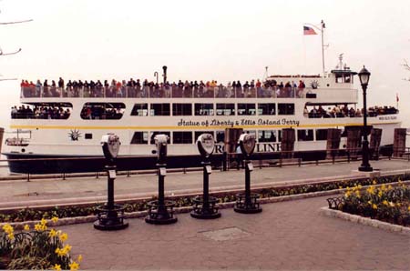 Statue-Ellis Island Ferry Miss Ellis Island at The Battery.
Battery Park itself spans 23 acres, much of it built on landfill beginning in the mid-19th century. From the sea wall, passenger ferries leave for Ellis Island and the Statue of Liberty. http://www.statueoflibertyferry.com/. The ticket office and information center is housed in Castle Clinton. Built as the West Battery in 1811, it was one of five forts designed to protect New York harbor from British attack, but none ever occurred. Originally the fort was completely surrounded by water and located 200 feet from shore. The designation came from DeWitt Clinton who served as both Mayor of New York City and Governor of New York State. From 1824 to 1855, it was known as Castle Garden, an entertainment center with a roof added. To organize and safeguard the increasing number of immigrants arriving in New York, the federal government converted Castle Garden into the Immigrant Depot, and from 1855 to 1890 eight million passed through its portals, representing two-thirds of those who legally entered the U.S. When the facility, now connected to shore, became overcrowded, the depot was moved to an expanded Ellis Island. The New York Aquarium took it over from 1896 to1941 until it moved first to the Bronx then in 1957 to its present site facing the Boardwalk at Coney Island. Castle Clinton was threatened with demolition during the construction of the Brooklyn Battery Tunnel, but a public outcry resulted in its designation as an historic site in 1946, by which time the upper story and roof had been demolished. In 1975, the fort reopened for its present function serving tourists bound for the Statue of Liberty and Ellis Island. Be sure to look inside at the dioramas showing how the tip of Manhattan changed over the years. Continuing along the sea wall, the poignant Merchant Marine Memorial (1991) shows the likenesses of two men on a ship, with one is trying to save a fellow crewmember from drowning. 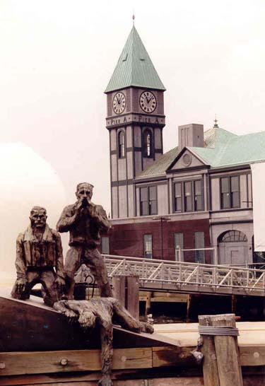 Merchant Marine Memorial & Pier A Pier A (1886) was originally built for the Department of Docks & Ferries then became a marine station for the Fire Dept. of the City of New York. The clock tower and chimes were added in 1919 as a WWI Memorial to the troops arriving home by sea. Its reconstruction into a restaurant and visitors’ center has currently stopped. Battery Park City and its 92 acres are built mostly on landfill from excavation for the World Trade Center and on sand from the harbor. Additional portions are constructed on a platform, and 24 acres is given over to parks and gardens. The complex combines commercial, residential and recreational uses plus road access partially designed to be an extension to the existing city street grid. The buildings represent the differing styles of several architects within a set of design guidelines. Robert F. Wagner, Jr. Park, laid out in 1996, offers flower gardens, bench seating, grassy surfaces to sit on, a viewing platform atop the brick arch, and a restaurant and toilet facilities tucked in underneath. On the north side stands the Ritz Carlton Hotel & Condominium (2001), now also housing the Skyscraper Museum (2004) with its entrance at the back facing west. http://www.skyscraper.org/. The Museum of Jewish Heritage (1997) has recently expanded its buildings into the park. http://www.mjhnyc.com/. Pass through a wooded section to The Esplanade, a splendid pedestrian and bicycle promenade stretching one mile from South Cove to North Cove. Note the recreated shoreline fringing South Cove. The attractive Battery Park City rental and condominium complex was largely constructed between 1986 and 1990. This new neighborhood also includes commercial enterprises to cater to residents and tourists and some varied examples of outdoor sculpture. At the north end, three towers make up the undistinguished Gateway Plaza Apartments (1982-3) 1,712 units developed by Samuel Lefrak. The World Financial Center (1985-1987), surrounding the North Cove, was designed by architect Cesar Pelli, offering seven million square feet of commercial and public spaces in 33- to 51-story buildings topped by a pyramid, step pyramid, dome or mastaba. Principal occupants are Dow-Jones, Merrill Lynch and American Express. The Winter Garden divides the complex and has sixteen 50-foot Florida palms within its barrel-vaulted interior, roughly the size of Grand Central Terminal’s main concourse. Restaurants, bars and stores lead off this monumental space. An the river end of the cove’s north side stands the Mercantile Exchange (1997), the world’s largest commodities trader, dealing in crude oil, natural gas, electricity, and precious metals. North Cove itself is home to charter and private yachts and a sailing school. The Irish Hunger Memorial, continuing along the sea wall past the Mercantile Exchange, appears to the right. It recalls the potato famine (1845-52) and famine worldwide on a one-half acre platform of Irish landscape, with stones and plants gathered from 32 counties and a reconstruction of a ruined cottage. Behind is Embassy Suites and a 15-screen cinema complex (2000). There is a view inland via Vesey Street to St. Paul’s Chapel (1766) and the Woolworth Building, at 792 feet, the world’s tallest from 1913 to 1930. Architect Cass Gilbert designed it in American Gothic style for Frank.W. Woolworth, a farm boy, who started with one store and went on to open over 1,000 by his death in 1919. Missing in the large gap is the World Trade Center and its twin towers that rose 110 stories and 1350 feet. New York Waterway’s temporary ferry terminal uses a pontoon-style landing until a much larger and more permanent facility is completed opposite the Mercantile Exchange. Passenger ferries operate to two landings in Jersey City - Exchange Place/Colgate and Harborside North, and to the Hoboken Terminal. http://www.nywaterway.com/.
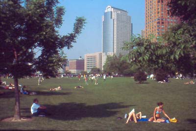 Rockefeller Park north end of Battery Park City. Rockefeller Park at BPC’s northwest corner offers recreation and relaxation, a children’s playground and well-maintained bathroom facilities. The park is overlooked by apartment buildings and the northward facing Stuyvesant High School (1993), Manhattan’s top public school with entry by admission tests. Hudson River Park, 550 acres and still under construction, begins its straight run here north to 59th Street offering 4.5 miles of bike and pedestrian paths paralleling State Route 9A (West Street). The linear park is part of the 32-mile Manhattan Waterfront Greenway, running around perimeter of borough and making up the south end of a planned pathway that will eventually extend northward to the Adirondacks. http://www.hudsonriverpark.org/. The West Side Elevated Highway (built 1931-1939) used to run above the street here, and some years after a small section collapsed in 1973, it was torn down. The area inland is Tribeca, a former manufacturing area whose designation means the Triangle Below Canal (Street).
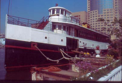 The Yankee at Pier 25. Pier 25 (N. Moore St.) is home to the Yankee, a 136-foot former steamboat built in 1907 to first operate as the Casco Bay ferry Machigonne on the coast of Maine; 1913-16 as a Boston-Provincetown boat; a troop carrier in WWI; from 1919 to 1920s to Ellis Island; the Statue of Liberty Hook Mountain for McAllister Navigation; a coastal troopship in WWI. In 1948 she was re-engined and renamed Yankee as a Block Island ferry for Interstate Navigation from New London and later Providence & Newport to B.I. After an accident damaged her bow in 1984, she was bought for restoration by Jim Gallagher who lived on it until 2003 when it was sold to Richard and Victoria Mackenzie-Childs. http://www.yankeeferry.com/. Pier 25 is also used for beach volleyball, mini-golf and outdoor art exhibits. Funding is not yet in place for redevelopment into a more substantial recreation pier and for short-term docking of small boats. Pier 26 is home for River Project, an ecological education & research center and the Downtown Boathouse used to store canoes and kayaks. Funds are being sought for upgrading both facilities.
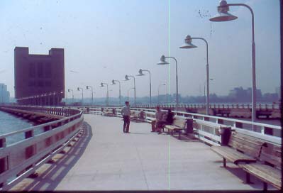 Pier 34 & Holland Tunnel Vent Shaft. Pier 34 (Spring St.) leads out to the Holland Tunnel Ventilation Shaft, serving the two underwater tube tunnels (South=8,371’ & North=8,558’) completed in 1927 and named after Clifford M. Holland, its Engineer. The south pier is open to public, and the north one serves as an emergency egress and for maintenance. New York Trapeze School is on the land opposite. Pier 40 (W. Houston St.) was built for Holland America Line in 1963, a steamship line that moved across the river from the 5th Street Pier in Hoboken. It’s square, rather than traditional finger pier design, could handle passengers, trucks, break-bulk freight and the emerging container business. After shipping moved out by the mid 1970s, the facility became an indoor/outdoor parking garage for 2,300 cars. Currently there are fields for soccer, baseball, rugby & football; offices of Hudson River Park Trust; a dock for excursion boats; and boat launching facility. A walkway, with benches, runs around the perimeter; and in the future, one half of the 1.2 million square feet must remain parkland while the other half may be commercial. The 1933 lighthouse tender Lilac is under restoration on the north side. The West Village in now opposite inland. Pier 45 (W. 10th St.) will become an 800-foot recreation pier with shade structures and a water taxi stop. Pier 46 (Charles St.) was finished in 2003 for recreation, seating, and a perimeter walkway. Pier 49 (Bank St.) is a pile field for wintering-over for striped bass population Pier 51 (Jane St.) is a maritime-themed playground, with climbing equipment & slides, and west end resembles bow of a ship; rest rooms are available on the esplanade. Pier 52 & 53 (Gansvoort St.) is a peninsula created with landfill, and is now the site for an inactive marine transfer station, a truck parking location for the NYC Sanitation Dept. and for salt storage. NYC Fire Dept. Marine Co. #1 is also located here. Formerly 13th Avenue, now just one block long, extended north to 23rd Street. Later excavations to allow the docking of longer ships eliminated most of the avenue. In the future, there will be a sandy beach, baseball fields, batting cages, and play lawn. The Fire Dept. is to remain at Pier 53, and the Dept. of Sanitation is to move off Pier 52. The Washington Meat Market is the burgeoning restaurant and residential district across West Street Pier 54 (W. 13th St.) is an open access public pier for RiverFlicks and RiverRocks, MTV Concerts, Wigstock, etc., with future passive uses. It was a Cunard and later a Cunard White Star Pier, with now only a steel arch remaining on which the steamship line name is faintly visible. In April 1912, 703 Titanic survivors arrived here aboard the Cunard liner Carpathia.1503 lives were lost in that disaster. On May 1, 1915, the 31,550grt Cunarder Lusitania sailed from here with 1,959 souls on board to be torpedoed by U20 on May 7th off Old Head of Kinsale, Southern. Ireland. The liner sank in 20 minutes and 1,198 lives were lost. Pier 56 is a pile field with a future rebuild for recreation. Piers 57, an Art Deco former Grace Line & French Line pier before that, was most recently a municipal bus parking garage. Future proposals (commercial use) include art galleries, dance studios, performing arts center, maritime museum, restaurants, not-for-profit offices, and possibly an Italian retail & cultural center. Pier 58 is a pile field. The former New York Central West Side Freight Line, elevated in 1934, is visible one block inland. Now owned by CSX and abandoned from Bank Street to the area of Penn Station (W. 34th Street), its future may be a linear park.
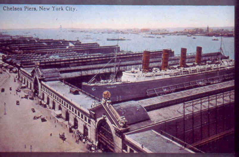 Chelsea Piers in the early 20th Century. The Chelsea Piers, 900-foot long and built 1902-1910 with head houses designed by Warren & Wetmore (architects for Grand Central), handled longest liners of Cunard & White Star such as Mauretania, Lusitania, Aquitania, Olympic & Titanic. The Titanic should have docked at Pier 60. The piers became obsolete by 1960s with containerization. The Chelsea Piers Sports & Entertainment Complex (1995) http://www.chelseapiers.com/, occupying Pier 59 to 62 spreads over 30 acres with 1.5 million sq ft of roller rinks, ice rinks, golf driving range (Pier 59 with a perimeter walkway), 55-foot rock climbing wall, gymnastics, basketball, soccer, swimming, batting cages, 40 bowling lanes, boxing, karate and dance classes, kayaking, sports medicine center, photo studios, marina, cruise & dinner boats, restaurants, sports shops. Large black and white photo murals effectively recall the shipping activities that used to take place here. Pier 62 (W. 22nd St.) offers in-line skating rinks and open space. In the future, a water taxi stop and fishing will be added.
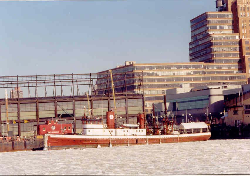 Fireboat John J Harvey at Chelsea Piers 1-26-03. Pier 63 (W. 23rd St.) houses Basketball City and a NYC Mounted Police Unit. Historic vessels include a barge, the 1931-built John J. Harvey, a former NYC fireboat offering wet excursions http://www.fireboat.org/, former lightship Frying Pan, and an Erie RR caboose, and rustic outdoor restaurant and bar. The upland is the future Chelsea Waterside Park Starrett-Leigh Building (brick with nine miles of banded windows) was completed in 1931 by the Starrett Corporation on the site of former Lehigh Valley RR freight terminal (later just occupying the ground floor). It served as a monumental 19-story modern warehouse-factory complex. The Lehigh Valley moved out in 1966, and it is now owned by Leona Helmsley and rented to mostly art-related tenants and Martha Stewart Omnimedia. To the North are the former Central Stores (1891), 25 buildings built on 24 acres for the Terminal Warehouse Company. Pier 66a is a restored B&O RR Car Float Transfer Bridge used between 1954 and 1973 as a freight car link to B&O Warehouse across West Street at 11th Avenue & 26th Street. Pier 64 served the former Panama Line and is condemned. The shed will be taken down for lawns and passive recreation. Pier 66 (W. 26th St.) is a pile field 30th Street Heliport serves tourists for sightseeing flights. http://www.libertyhelicopters.com/. Pier 72 (W. 32nd St.) is a pile field. Jacob Javits Convention Center (1986) was designed by the firm of I.M. Pei, and its 1.8m square feet accounts for nearly 2% of city’s economy. A planned expansion extends northward. Pier 76 (W. 36th St.) is a former United States Lines early container pier, then a car impound lot. Its future is half recreational with uses such as pavilions, fishing, and performance spaces.
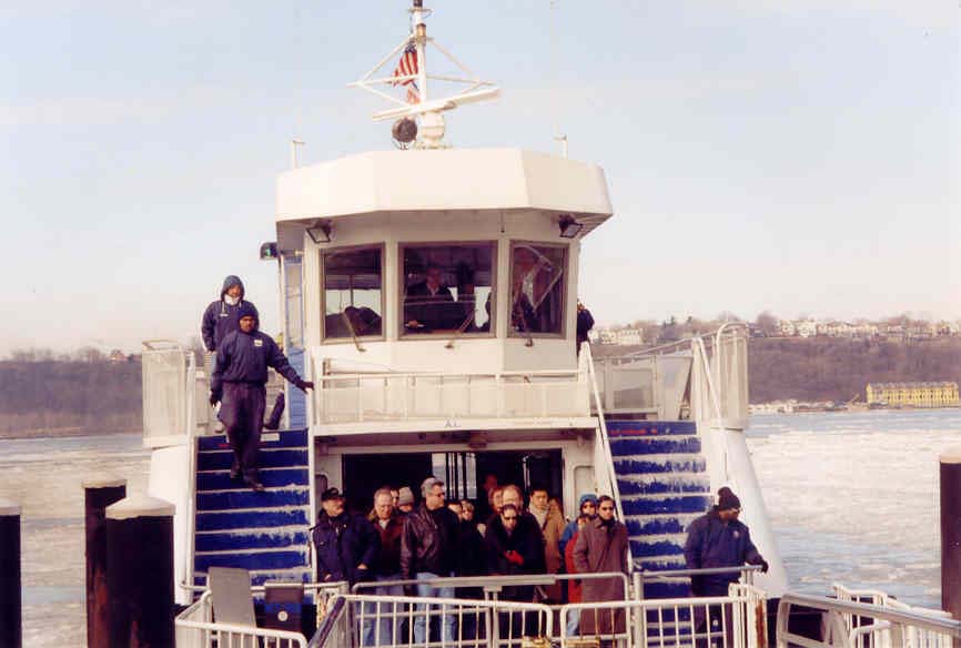 NY Waterway ferry docks 1-26-03. Pier 78 (W. 38th St.) serves NY Waterway Ferry. http://www.nywaterway.com/. Service started in 1986 to Port Imperial Weehawken, then expanded to Hoboken, Lincoln Harbor, Newport (Pavonia), and Colgate, plus sightseeing excursions up the Hudson and to Sandy Hook, NJ. The private ferry is owned by Arthur Imperatore and operated by his son Arthur Jr. Connecting red, white & blue buses fan out across midtown and downtown. Pier 79 (W. 39th St.) is the Lincoln Tunnel Vent Shaft and NY Waterway bus garage and is currently undergoing construction as a greatly expanded ferry terminal. Lincoln Tunnel’s center tube was completed in 1937; the north tunnel in 1945, and the south in 1957. The lengths are between 7,482 and 8,216 feet, and it is the busiest tunnel in world with 40 million vehicles a year. The area inland was known as Hell’s Kitchen and is now more commonly called Clinton. Piers 81 & 83 – 81 was the Hudson Day Line pier with service up the Hudson to Bear Mountain, West point and stops to Albany, and it now serves World Yacht’s dinner boat fleet. http://www.worldyacht.com/. Pier 83 is for Circle Line, http://www.circleline.com/, operating round Manhattan cruises since 1944. Pier 84 (W. 44th St.) has been cut back and is now closed. Its future may be a public boathouse, gardens and classrooms.
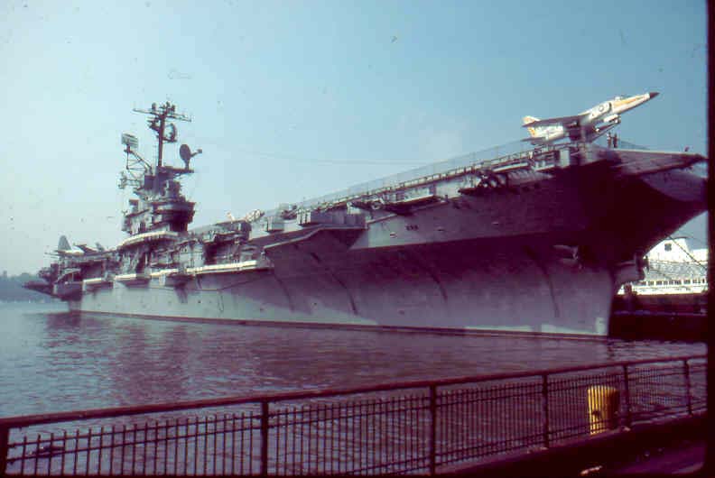 INTREPID Sea-Air-Space Museum. Pier 86 serves the Intrepid Sea-Air-Space Museum, including a fleet of US Navy & US Coast Guard Ships; the British Airways Concorde on a barge, and US, Polish, French, British aircraft. More exhibits are within http://www.intrepidmuseum.com/.  Queen Mary 2 and Norwegian Dawn Passenger Ship Terminal.
Piers 88-90-92 is the Passenger Ship Terminal with five berths for cruise ships, including the Queen Mary 2. The complex is now inadequate and is to be rebuilt. For sailings see http://www.worldshipny.com/. Pier 94 is a former Cunard Line freight pier, and its future is to be the UnConvention Center for trade shows under NYC Economic Development Corporation. Pier 95 served Furness-Bermuda Line, and with former Pier 96, a future Clinton Cove Park, boathouse and boat ramp. Pier 97 served Swedish-American Line and Home Lines, and is now used for NYC Sanitation truck parking. Its future will be part of Clinton Cove Park with sports facilities, boathouse and dock. Pier 98 & 99 – Pier 98 is for Con Edison parking and barge delivery, and Pier 99 is a sanitation pier, a waste transfer station. Inland is the IRT Powerhouse (1904), McKim, Meade & White, originally coal-fired hence location near river. Riverside South, a Donald Trump housing complex, stretches from 59th to 72nd Streets and built on the former New York Central West Side Freight Yards, serving a line that ran elevated from Houston Street northward to just west of Penn Station, then sub-surface, surface, and elevated to cross Harlem River at Spuyten Duyvil and connect with the ex-New York Central Line from Grand Central. The line from here to Poughkeepsie is now Metro-North and Amtrak trains run from Penn Station further up the Hudson to Albany, north and west. Trump bought railroad yard land in 1983 for $95 million to establish a now partly completed complex of 16 residential buildings of 15 to 49 stories housing 5,700 residences. The riverfront path continues north in the shadow of the now elevated Henry Hudson Parkway. NYC Car Float Piers once connected New York Central’s West Shore Line railroad facilities (now Port Imperial) to the West Side Freight Yard. The collapsed pier burned in July 1977 and one gantry will be restored as part of the new riverfront park still under construction.
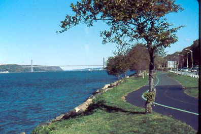 Riverside Park Path North to the George Washington Bridge. , Riverside Park (1873-1910) was originally designed by Frederick Law Olmsted (Central Park fame) and completed by Charles Vaux & Samuel Parsons. Frederick Law Olmsted Jr. made changes to allow the current Henry Hudson Parkway to be completed in 1937. A waterside path continues the length of Riverside Park, around the North River Sanitation Plant and up to the George Washington Bridge.. |
| http://www.worldshipny.com/index.html |