 |
New York Architecture Images-New
York Bridges Throgs Neck Bridge |
||||||||||||||||||||||||||||
| Contemporary black and white images on this page copyright Dave Frieder ( www.davefrieder.com ). Special thanks to Dave Frieder for permission to use images. | |||||||||||||||||||||||||||||
|
architect |
Othmar Ammann | ||||||||||||||||||||||||||||
|
location |
between the Bronx and Queens | ||||||||||||||||||||||||||||
|
date |
1961 | ||||||||||||||||||||||||||||
|
style |
Structural Expressionism, International Style II | ||||||||||||||||||||||||||||
|
construction |
|||||||||||||||||||||||||||||
|
type |
Suspension Bridge | ||||||||||||||||||||||||||||
|
data |
|
||||||||||||||||||||||||||||
|
|
      |
||||||||||||||||||||||||||||
|
images |
    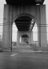  |
||||||||||||||||||||||||||||
|
|
     |
||||||||||||||||||||||||||||
| Dave Frieder Gallery. Copyright Dave Frieder ( www.davefrieder.com ) | |||||||||||||||||||||||||||||
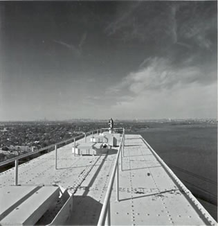 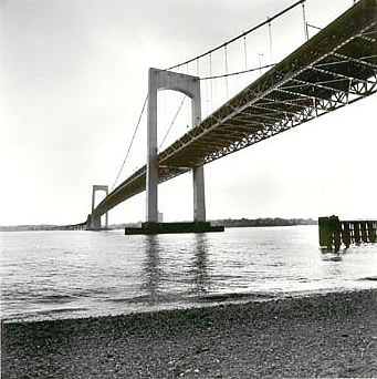 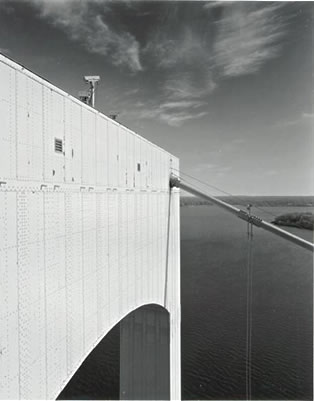 |
|||||||||||||||||||||||||||||
|
Opened in 1961, the Throgs Neck Bridge was built between the Bronx and Queens to ease congestion on the Bronx Whitestone Bridge. Traffic on each of these bridges now exceeds the number of vehicles carried by just the Bronx Whitestone when it stood alone. Astride the meeting place of the East River and Long Island Sound, the bridge serves as a vital link in the city's interstate highway system. On the Bronx side it feeds into the Cross Bronx and Bruckner expressways, the Hutchinson River Parkway, and the New England Thruway, providing access to New Jersey, upstate New York, Westchester County. and New England. On the Queens side it feeds the Cross Island Parkway, the Clearview and Long Island expressways, and the Grand Central Parkway, which lead, respectively, to Long Island, Manhattan, Brooklyn, and points west. The bridge's Bronx neighborhoods are the residential communities of Throgs Neck and Locust Point and the S.U.N.Y. Maritime College at Fort Schuyler. On the Queens side are the residential communities of Beechhurst, Bayside, and Little Bay Park, as well as historic Fort Totten. The name Throgs Neck was derived from that of John Throckmorton, who settled in the area in 1643. THE NEWEST EAST RIVER SPAN: Unlike many bridges proposed by Robert Moses, the Throgs Neck Bridge was not part of the circumferential highway network proposed in 1929 by the Regional Plan Association (RPA). With the postwar era dawning, Moses proposed a series of new bridges and connecting expressways to meet anticipated growth in vehicular traffic. One proposal in his 1945 plan had a "Throgs Neck" span situated two miles east of the Bronx-Whitestone Bridge. Although Moses
received a windfall from his Triborough Bridge and Tunnel Authority
(TBTA), he needed additional Federal and state funds to fulfill his
ambitious plans. Unlike his earlier arterial proposals, he received
neither immediate funding nor unanimous support. The turning point came
in the mid-1950's, when the Federal Bureau of Public Roads (BPR)
expressed interest in building the Interstate highway system. Believing
that he could obtain Federal and state funds for his arterial proposals,
some of which had been shelved for years, Moses pitched a joint plan
developed by the TBTA and the Port of New York Authority before the BPR.
Two alternate designs for the Throgs Neck Bridge. LEFT: The original 1955 design by Othmar Ammann featured taller towers, a 3,100-foot-long main suspension span and 900-foot-long side spans. RIGHT: This 1957 design by John P. Peterkin featured corduroy-textured towers (part of a 1950's design convention) with squared-off portals. (Photo renditions by Triborough Bridge and Tunnel Authority.) DESIGN AND CONSTRUCTION: Once again, Moses commissioned Othmar Ammann for bridge design work. In approaching the design of his first long-span suspension bridge since the Tacoma Narrows Bridge disaster, Ammann was fully aware of public fears about deck movement. For the Throgs Neck Bridge, he employed a more conservative design. In many respects, the design of the Throgs Neck Bridge is similar to that of the retrofitted Bronx-Whitestone Bridge two miles to the west. The Throgs Neck Bridge was
designed with a 28-foot-deep stiffening truss. The raising of the deck
began at each tower and proceeded simultaneously toward midspan and the
approach roads. The single-deck structure carries six lanes of vehicular
traffic that rest on a series of laterally arranged transverse floor
trusses. These transverse trusses are framed into two longitudinal
stiffening trusses located in the vertical planes of the suspension
cable. A lateral system of stiffening trusses between the top and bottom
chords of the truss provides additional bracing. Together, the system of
lateral, longitudinal and transverse trusses forms a rigid frame that
offers sample resistance to load and wind forces. The concrete pavement
rests atop this extensive truss system, providing motorists with
unobstructed views of New York City and Long Island Sound. |
|||||||||||||||||||||||||||||